Mission Ribbon
|
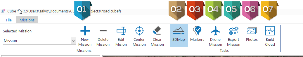
Activity to manage the Multi-mission management; Zone where the user can manage several mission of survey by drone |
|
Activity to manage the 3D survey by Web: Google map or SRTM or Esri ascii grid This task can be used to calculate a 3D model and Level curves or to calculate the terrain aware for the Drone mission |
|
This activity defines the Markers to use in the project: Markers defined on the map: they will be reference but they cannot be used as Geo reference for the photos or the model. Markers of GPS imported or taken by the live Blue Tooth connection to your GPS |
|
This activity allows to define the type and location of Drone Survey mission |
|
This activity allows to export a drone mission to external application as Flight control such as Litchi |
|
This activity allows to import the photos taken by one or several drone mission to build a 3D point clouds and 3D mesh model. |
|
This activity allows to build a 3D point cloud and 3D mesh model and generate a report. In this activity there is also the possibility to navigate the 3D point cloud and Mesh 3D In this activity there is also task to navigate the Photo - mosaic In this activity there is also task to make a 3D Virtual Survey |


