Before You Begin
Home > 24 Terrain > Before You Begin
Before You Begin
Data for generating landscape maps and models in ARC+ must be in one of the following formats:
ASCII files containing a list of X,Y and Z coordinates
ARC+ file containing geometric points in 3D space
ARC+ file containing text entities
ARC+ file containing open and/or closed polygons
Source data containing geometric points or text entities may be either built in ARC+ or imported using the Importing a DXF or DWG File (\dxfin or \dwgin) (see Files).
The system generates the maps and models by interpolating contours between specified points and/or coordinates.
Using ASCII Files
ASCII files used for generating topographic models must conform to the following conventions:
Files must contain only the required X,Y and Z coordinates. Delete all additional data such as column titles, row numbers, etc.
File extension must be *.xyz.
Coordinates must be entered in the order X Y Z.
Each column must be delineated by a space or a comma.
Space delineated:
|
147750.4 |
902691.9 |
130.99 |
|
147484.1 |
902921.5 |
175.95 |
|
147119.4 |
902800.4 |
177.78 |
Comma delineated:
|
147750.4 |
902691.9 |
130.99 |
|
147484.1 |
902921.5 |
175.95 |
|
147119.4 |
902800.4 |
177.78 |
 IMPORTANT Invalid column delineation, such as an extra comma between columns, may distort the image of your model by translating the invalid character into a coordinate.
Using ARC+ Files
Source files may be in the form of an ARC+ or DXF/DWG file. Use the Importing a DXF or DWG File (\dxfin or \dwgin) command to import DXF files. The files can contain text or points.
ARC+ File Containing Geometric Points:
These ARC+ files consist of a series of point entities in 3D space. Each point represents a location on the surface of the terrain. Verify that the file contains only the required points.
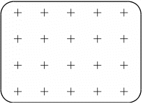
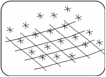
 NOTE Points may be arranged on a rectangular grid or irregularly in space.
ARC+ File Containing Text Entities:
These ARC+ files consist of a series of text entities, where the Z value is indicated by the text. The X Y values of the each text entity are indicated by the text justification point. Verify that the file contains only the required points.
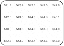
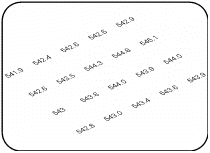
 NOTE Text entities may be arranged on a rectangular grid or irregularly in space.
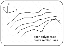
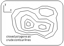
ARC+ File Containing Polygons:
These ARC+ files contain open or closed polygons. The XYZ values of every point of each polygon are converted to points for terrain interpolation.
Related Topics
