Randomly Generated Fractal-Based Models
Home > 24 Terrain > Randomly Generated Fractal-Based Models
Randomly Generated Fractal-Based Models
An additional option offered by the terrain modeler enables you to generate random coordinates to create a landscape. These models are based on fractal geometry, to generate terrain similar to natural land forms. Fractal models may be used for training, demonstration and experimental projects.
The fractal factor you indicate controls the roughness of the generated landscape. The higher the factor the rougher the terrain.
Create a topographic model with random fractals by selecting the fractals button from the Terrain Modeler dialog box.
Creating a Fractal Model
Fractal models may be generated as triangulated networks, or generate terrain input files in the following formats:
ASCII files containing X Y and Z coordinates
ARC+ files of text entities
ARC+ files with set points in 3D space
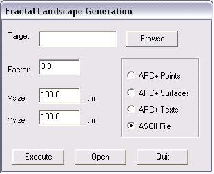
Select the fractal option from the Terrain Model dialog box to generate a fractal model.

Enter the name of your file in the target field. The file is stored in your current working directory.
Enter a fractal factor between 0 and 10 in the fractal field. The larger the number, the rougher the terrain.
Enter the X and Y dimensions for the size of the site in the X size and Y size fields.
Choose an output type. See Fractal Models above for more information.
Choose execute to generate the file.
Open the point, surfaces and text files as you would open any ARC+ file. Open the ASCII file using an external text-editing tool.

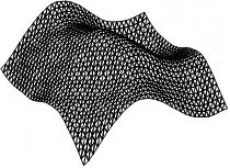
Triangulated Fractal Model
Parameter 0-3

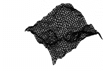
Triangulated Fractal Model
Parameter 3-6

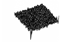
Triangulated Fractal Model
Parameter 6-10
