3D Map creation
Cube-fly supports the Multi Missions, it means that the user can define several zones where he can make a web survey o a drone survey.
Particularly interesting is to create a mission that include spatially all other missions and use it to calculate the 3D terrain by web or Esri survey and use to make the terrain aware for all included missions.
|
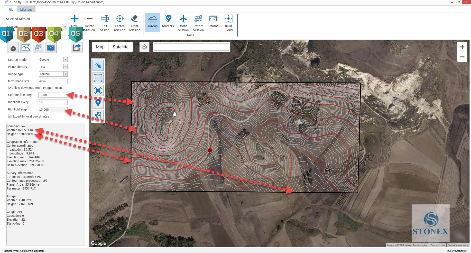
It downloads the data of 3D points STRM or Google according the "Source model" and "Point density" parameters.
|
|
It downloads the image or images from Google maps according the parameter "Allow download multi images", if this is activated Cube-fly will download several images to create a high resolution mosaic. |
|
It creates the contour lines according the parameters "Contour lines step" and "Highlight every". |
|
It allow the navigation off line of mosaic, TIN and contour lines as indicated in the next section |
|
It exports the TIN, mosaic and contur lines in several format such as DXF, 3DS, DAE, OBJ, and several others |


