Smart photo shift
Smart photo shift
|
Select the photo taken by the drone at the take-off point (at the end of the procedure it will be automatically excluded from the dataset) |
|
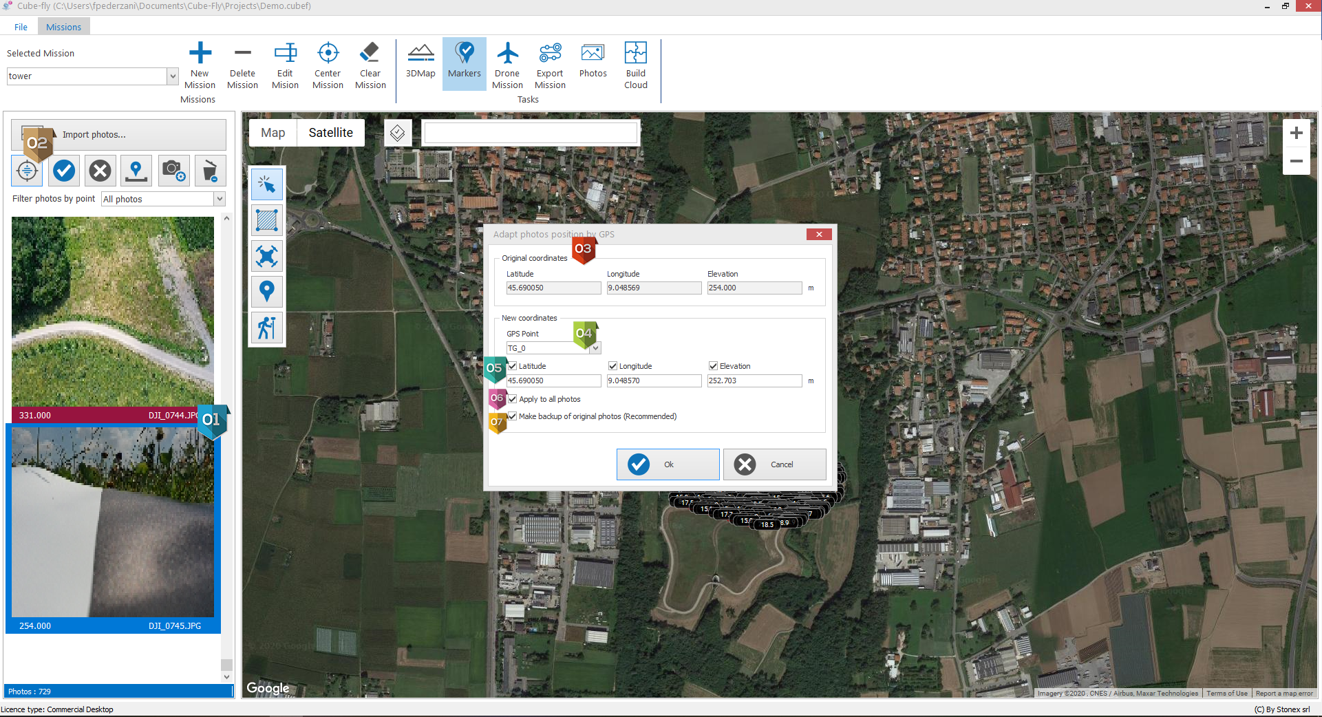
It opens the dialog to adapt photos position by GPS. |
|
The original coordinates are the EXIF in the photo taken by the drone. |
|
Select the marker measured in on the take-off point. |
|
Tick which coordinates you want to shift (latitude, longitude and/or elevation). |
|
Tick if you want to apply the shift correction to all the images. |
|
Tick if you want to make backup of the original photos. |


